次日,我們的船停靠在 Juneau 這個城市。它是阿拉斯加州的首府,以首都城市來說,Juneau 的規模實在是小得讓我吃驚。根據維基百科的記載,它的人口只有三萬一千人。但更讓我訝異的是,身為州政府所在地,Juneau 竟然沒有任何陸面交通方式可以到達。所有人、所有物資,都要從海路或空運進入這個城市。這聽起來實在是超級不方便,但是早期的住民還是有辦法來到這裡,而且還建立了這麼一個城市。從這個角度來看,三萬一千人的城市突然又讓我覺得很大了。
Unlike yesterday's stop at Katchiken, our stop at Juneau is very long. We arrive in the morning and leave by 9PM, so we really have a full day to explore the city and beyond. Again, since this is our first time here, we decide to spend time on our own and do mainly tours to the most popular destinations.
今天我們在 Juneau 預計停留的時間比昨天長得多了,一早就靠岸,要晚上九點才離開。這讓我們有很足夠的時間可以參觀這個城市和市郊一些景點。既然我們是第一次造訪,我們決定只進行簡單的市區觀光,另外前往一兩個最重要的知名景點。
Our first stop is Mount Roberts. This is a mountain next to the city, providing a good view of the near by area. Theoretically, you can hike up, but there is about 2000 feet elevation gain. I don't think my parents are prepared for this. Alternatively, there is a tramway stop right at the cruise ship dock, and it takes you right from your ship to the observation deck at about 1800 feet. Sounds like a perfect tourist trap, is it not? The ticket price is a hefty $27/person, but there is no way to escape this. We take the tram up to the mountain the first thing in the morning, since the ticket is good for the whole day we can again come back for a different view in the late afternoon, too.
我們第一個前往的是 Mount Roberts,這是 Juneau 這個城市旁邊的高山,從山頂可以看到整個城市的景觀。理論上來說,我們可以選擇走路上山,但是這條路有些陡峭,要徒步爬升2000呎,不太適合我的父母親。另外一個比較大眾化的選擇,則是從遊輪停靠的碼頭,有一個纜車可以直接帶遊客不費吹灰之力爬升1800呎,來到山腰的展望台。這聽起來實在是太像挖好準備坑殺觀光客的陷阱了,而且纜車票價每人27元並不便宜,但最後我們還是決定,既然自己是觀光客,那就去填觀光客該填的坑好了。反正來到觀光味這麼重的地方,到此一遊的事,總還是得做的。我們一大早就先上山一趟,而纜車票是全日有效,所以想要的話,我們傍晚還可以再來看不同光線下的 Juneau 市景觀。
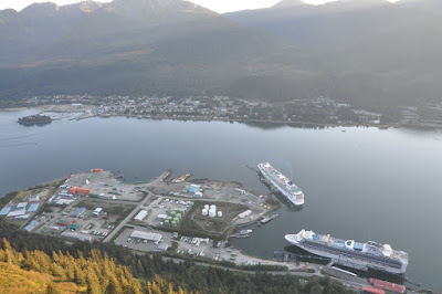
 【Good view of Juneau. This is the whole of it. It is not the typical "capital city" we have in mind after all.】
On top of Mount Roberts, there is not just an observation deck, but also a good trail system, relatively flat, where you can hike around for about 30 minutes (or much longer if you want to go to the top of mountain). The trail system is occupied by all tourists coming out of the ships - I can easily tell them apart because the cruising company gives out small handbags with their logo on it, and many people carry it around. The scenery is nice, the air is fresh, and it is a much needed exercise after spending 3 days on a cruise ship. I think it is worthwhile to come up here.
在 Mount Roberts 山上,從纜車站走出來,不只有觀景台,還有一個不錯的步道系統。這個步道和登山的部分比起來相對平緩,全長大約三十分鐘一圈(如果有人有興趣往 Mount Roberts 山頂走的話那就長得多)。一早的步道上充滿了從遊輪裡出來的觀光客,很容易辨認,因為不少人手上都拿著船上發的有船公司 logo 的手提袋。這個步道風景不錯,空氣清新,更重要的是它提供了我們一行人坐了三天船也大吃大喝了三天之後,非常需要的運動。整體來說,我覺得第一次來 Juneau 的話,上山一趟還是蠻值得的。
 【Here I am】

 【An interesting tree carving next to the trail】
在 Mount Roberts 山上,從纜車站走出來,不只有觀景台,還有一個不錯的步道系統。這個步道和登山的部分比起來相對平緩,全長大約三十分鐘一圈(如果有人有興趣往 Mount Roberts 山頂走的話那就長得多)。一早的步道上充滿了從遊輪裡出來的觀光客,很容易辨認,因為不少人手上都拿著船上發的有船公司 logo 的手提袋。這個步道風景不錯,空氣清新,更重要的是它提供了我們一行人坐了三天船也大吃大喝了三天之後,非常需要的運動。整體來說,我覺得第一次來 Juneau 的話,上山一趟還是蠻值得的。
 【Here I am】

 【An interesting tree carving next to the trail】
After the short hike, we come down from the mountain and decide what to do the next. Juneau has a must-see attraction for first time visitors, Mendenhall Glacier, which we decide to go the next. To get to there, one can join the shore excursion organized by the cruise company, buy a group tour organized by local business at the dock, or just take city bus. Since I did not do my homework on city bus, we end up with the local tour company. We choose a combo package of shuttle to Mendenhall Glacier plus city tour. Good thing about this package is, we can decide which one to do first, and we are not tied to a specific shuttle bus when we go to Mendenhall Glacier - we can stay as long as we like there, just be sure to take the last shuttle back.
山上的晨間運動結束之後,我們下到平地,開始打算下午要去哪邊。對第一次來 Juneau 的觀光客來說,市郊有一個必去的景點 Mendenhall Glacier,我們也決定接下來就要去那邊。 Mendenhall Glacier 在城外稍遠的地方,需要稍微安排一下交通。有三種可行的方法:一是參加船公司安排的團體上岸行程,二是在碼頭上加入當地旅行社組織的旅行團,三是自己搭市公車前往。因為這次我行前匆忙,沒有做市公車的功課(據說九月中已經停駛了,我也不是太確定),我們只好選擇當地的旅行社。在碼頭邊的票亭比較了幾個不同行程之後,我們選擇了 Mendenhall Glacier 和 city tour 二合一的行程。這個行程的優點是,我們可以自己決定要先去哪一個,而且在 Mendenhall Glacier 也沒有排定的回程時間,所以行動很自由,可以待多久都行,只要小心不要錯過最後一班車即可。
 【Ticket booths at the dock. This is a convenient way to find out what is available.】
山上的晨間運動結束之後,我們下到平地,開始打算下午要去哪邊。對第一次來 Juneau 的觀光客來說,市郊有一個必去的景點 Mendenhall Glacier,我們也決定接下來就要去那邊。 Mendenhall Glacier 在城外稍遠的地方,需要稍微安排一下交通。有三種可行的方法:一是參加船公司安排的團體上岸行程,二是在碼頭上加入當地旅行社組織的旅行團,三是自己搭市公車前往。因為這次我行前匆忙,沒有做市公車的功課(據說九月中已經停駛了,我也不是太確定),我們只好選擇當地的旅行社。在碼頭邊的票亭比較了幾個不同行程之後,我們選擇了 Mendenhall Glacier 和 city tour 二合一的行程。這個行程的優點是,我們可以自己決定要先去哪一個,而且在 Mendenhall Glacier 也沒有排定的回程時間,所以行動很自由,可以待多久都行,只要小心不要錯過最後一班車即可。
 【Ticket booths at the dock. This is a convenient way to find out what is available.】
It turns out the city tour part is kind of boring. The trolly driver takes us around the city and tells several stories about the city. But it is mostly street view of not so interesting buildings. The story-telling skill of the driver needs some more work, too. The trolly does make a stop across the fjord at Homestead Park, where we can see the city from across the sea. That is about it.
很可惜的,市區觀光的部分實在有些無聊。我們坐著一台觀光車在市區裡繞來繞去,司機一邊講這個城市的故事。但是 Juneau 的街景實在不是那麼有趣,而司機大哥講故事的能力,也有待加強。這班觀光車最遠開到 Juneau 跨過峽灣的對岸,有一個叫 Homestead Park 的地方,可以隔岸遠望 Juneau 的市容。大概就只有這樣子。
 【Crossing the bridge to the other side of the fjord】
 【View of the city of Juneau】
很可惜的,市區觀光的部分實在有些無聊。我們坐著一台觀光車在市區裡繞來繞去,司機一邊講這個城市的故事。但是 Juneau 的街景實在不是那麼有趣,而司機大哥講故事的能力,也有待加強。這班觀光車最遠開到 Juneau 跨過峽灣的對岸,有一個叫 Homestead Park 的地方,可以隔岸遠望 Juneau 的市容。大概就只有這樣子。
 【Crossing the bridge to the other side of the fjord】
 【View of the city of Juneau】
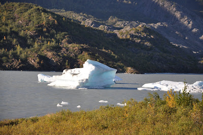
The second part of this package is definitely more interesting. We do have to wait for a while for the shuttle to arrive, and it is packed. Mendenhall Glacier is about 20 minutes ride from Juneau and this is our first encounter with the many glaciers we will see on this trip. One interesting thing about this Mendenhall Glacier is that the actual glacier is quite a bit further away from the visitor information center. This is an accident, not by design. When the visitor center was constructed, it sit right next to the tip of glacier. Over the years, Mendenhall Glacier has receded significantly, and it is now considered a hike to go from the visitor center to the tip of glacier. Climate change has played its role, perhaps even more significantly, in the North country.
套裝行程的另一半無疑就有趣地多了,雖然等車等了有那麼一點久,而車上又擠得滿滿滿。Mendenhall Glacier 從市區大約有二十分鐘的車程,這也是我們這趟充滿了冰河的行程裡,看到的第一個冰河。一眼望去,這 Mendenhall Glacier 有個古怪的地方 - visitor center 蓋得好像離冰河有那麼點遠,前不著村,後不著店。這其實是意外造成的,不是故意這樣設計。原來 visitor center 多年前建成的時候,的確是位在冰河的前端的旁邊。幾十年來,Mendenhall Glacier 消退的情形非常嚴重,以致於現在從 visitor center 走到冰河前端已經算是一個 hike 了。即使在這遙遠的北國,我們也可以看到全球氣候變遷明顯的事證,比起我們熟悉的身邊,影響程度可能更有過之。
 【Mendenhall Glacier. I took this picture close to visitor center. The tip of glacier used to be here and now it is like one mile away. Even at this distance, the wind blowing in from glacier is bone chilling. We all need to put on hats to prevent headache.】
 【Closer look at the glacier. It is something so different from my day to day life experience.】
 【This is at the end of a short trail. Soon this trail will be not enough for people to get a close view at the glacier.】
套裝行程的另一半無疑就有趣地多了,雖然等車等了有那麼一點久,而車上又擠得滿滿滿。Mendenhall Glacier 從市區大約有二十分鐘的車程,這也是我們這趟充滿了冰河的行程裡,看到的第一個冰河。一眼望去,這 Mendenhall Glacier 有個古怪的地方 - visitor center 蓋得好像離冰河有那麼點遠,前不著村,後不著店。這其實是意外造成的,不是故意這樣設計。原來 visitor center 多年前建成的時候,的確是位在冰河的前端的旁邊。幾十年來,Mendenhall Glacier 消退的情形非常嚴重,以致於現在從 visitor center 走到冰河前端已經算是一個 hike 了。即使在這遙遠的北國,我們也可以看到全球氣候變遷明顯的事證,比起我們熟悉的身邊,影響程度可能更有過之。
 【Mendenhall Glacier. I took this picture close to visitor center. The tip of glacier used to be here and now it is like one mile away. Even at this distance, the wind blowing in from glacier is bone chilling. We all need to put on hats to prevent headache.】
 【Closer look at the glacier. It is something so different from my day to day life experience.】
 【This is at the end of a short trail. Soon this trail will be not enough for people to get a close view at the glacier.】
Of course, the experience at these Alaska ports is never complete without walking through the streets and checking out the famous tourist stops. Yeah, call it touristy. Call it boring. But as first time visitors we have to do it.
當然,阿拉斯加之旅的一路上,不論停了哪一個港,都免不了要在碼頭附近漫步,看看當地一些有名的觀光客必去景點。啊,沒錯,真的是很死觀光客行程,很俗套,但是第一次來的我們還是一定要去的。
 【Red dog saloon is the most famous saloon in town and it is on every single tour book or information website for Juneau. While we are here, there are a lot of people just step in to take a peek, and walk back out. I wonder how they manage to run business with so many spectators.】
 【Street next to the dock. Full of shops. There are really few interesting, most of them are just typical shops. This is part of tourism.】
 【T-shirt outlet at the dock. End of season sale is on! 7 bucks for a T-shirt! Wo-hoo!! Almost everyone has a bag from this store when coming back to the ship】
當然,阿拉斯加之旅的一路上,不論停了哪一個港,都免不了要在碼頭附近漫步,看看當地一些有名的觀光客必去景點。啊,沒錯,真的是很死觀光客行程,很俗套,但是第一次來的我們還是一定要去的。
 【Red dog saloon is the most famous saloon in town and it is on every single tour book or information website for Juneau. While we are here, there are a lot of people just step in to take a peek, and walk back out. I wonder how they manage to run business with so many spectators.】
 【Street next to the dock. Full of shops. There are really few interesting, most of them are just typical shops. This is part of tourism.】
 【T-shirt outlet at the dock. End of season sale is on! 7 bucks for a T-shirt! Wo-hoo!! Almost everyone has a bag from this store when coming back to the ship】
Finally, before boarding the ship, we go back to Mount Roberts again. I know the view is not going to be very different, but since the tramway stop is just next to our ship, I figure it is a good idea to catch some sunset view.
最後,再上船之前,我們又再次坐纜車登上 Mount Roberts。當然,一天看兩次並不會看到什麼不一樣的風景,不過既然纜車站就在上船的碼頭旁邊,上來看看落日還是不錯的。
最後,再上船之前,我們又再次坐纜車登上 Mount Roberts。當然,一天看兩次並不會看到什麼不一樣的風景,不過既然纜車站就在上船的碼頭旁邊,上來看看落日還是不錯的。


